Draws over real ground
Locate a property, work at true scale, and place infrastructure where it actually sits — not on a blank sheet.
For ranchers, farmers, and contractors
FieldFlowCAD is browser-based irrigation CAD. Type an address, trace your fields over aerial imagery at true scale, and lay out ditches, pipes, headgates, risers, and ponds. The drawing sizes itself, simulates the water, and prices the work — with no CAD license and nothing to install.
What it is, in one line: a drawing tool that understands irrigation objects. A line is not just a line — it is a 6-inch PVC mainline or a trapezoidal earth ditch with a grade, a capacity, and a cost.
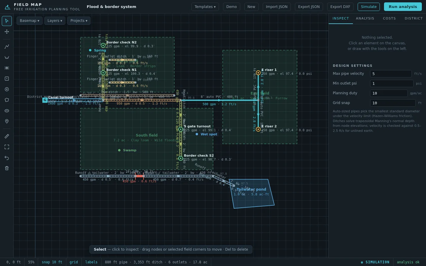
Locate a property, work at true scale, and place infrastructure where it actually sits — not on a blank sheet.
USGS 3DEP elevation, generated contours, and USDA soil detection inform slope, intake rate, and field water requirement.
Ditches, pipes, headgates, turnouts, and risers are sized from the drawing, with velocity, pressure, and grade warnings.
Open gates and watch live flow totals, gallons, acre-feet, and field application build up. Flow only animates when a valid source actually feeds the segment.
Material lists, repair parts, estimated and actual cost, and work-order budgets come from the same drawing.
Pull canals, diversions, parcels, and water-right references from public agency data where it is available.
FieldFlowCAD shows its methods instead of hiding them, so a contractor or district engineer can check the work:
The solver handles directed, branched networks. Looped or multi-source networks, backwater, and transients are outside its scope, and the app fails visibly rather than inventing a flow split.
Planning estimate, not a stamped design. These are steady-state equations. Real accuracy depends on surveyed elevations, current channel and pipe condition, calibrated gate ratings, and pump curves. Verify in the field and get qualified engineering review before final construction or official operation.
No. It is built to be simple enough for someone who has never opened CAD and precise enough for the contractor, water official, and crew who have to build and run the system.
Projects are local-first: they live in your browser. Server storage is used only when you explicitly share a project or use cloud saves on a membership.
Yes. Export DXF for CAD and GIS, JSON for a full project backup, or PNG for a quick print.
Your first project is free with no card. Unlimited projects and cost estimates are $19.99 a month or $199 a year. See pricing.
Type an address and start drawing. No card, no install.